Modern navigation applications have evolved far beyond simple digital road atlases. Today, platforms like Google Maps and Waze serve as comprehensive, real-time transportation networks that dictate how millions of commuters navigate their daily lives. Beyond calculating the fastest routes and monitoring shifting traffic density, these apps offer intricate layers of localized data, warning drivers of impending road closures, lane obstructions, speed traps, construction zones, weather-related hazards, and law enforcement presence. For millions of motorists, receiving a timely notification that a police vehicle or speed trap is positioned just around the bend has become a routine part of driving. Yet, this seamless capability often prompts a lingering question among tech-savvy users: how do GPS applications instantly acquire such hyper-local, dynamic information?
The underlying mechanics involve a complex interplay of artificial intelligence, machine learning, telematics, and a vast, global network of crowdsourced human intelligence. While traditional traffic tracking relies on automated data feeds, detecting law enforcement requires direct human participation. By examining the structural evolution of crowdsourced navigation, the integration of companion apps, and the broader societal implications of real-time police tracking, a clearer picture emerges of how modern smartphones keep drivers informed—and how these digital ecosystems operate behind the scenes.
The Evolution of Traffic Telematics and Automated Data Collection
To understand how navigation apps detect police presence, it is first necessary to distinguish how they gather general traffic data versus how they capture localized incidents. For over a decade, major GPS providers have utilized passive crowdsourcing to monitor vehicle speeds and congestion levels. When a motorist drives with an active map application on their smartphone, the device continuously transmits anonymous telemetry data—including speed, direction, and GPS coordinates—back to the company’s servers.
By aggregating this data from thousands of vehicles traveling along the same stretch of highway, algorithms can instantly identify bottlenecks, accidents, and slowdowns. In recent years, companies like Google have heavily invested in machine learning and predictive AI models. These systems analyze historical traffic patterns alongside live telemetry to forecast how congestion will evolve over the course of a commute.
However, automated telemetry alone cannot identify stationary hazards, debris on the roadway, or police vehicles parked discreetly on the shoulder. While a sudden drop in average vehicle speed might indicate a slowdown, it cannot explain the root cause. To bridge this information gap, developers turned to active crowdsourcing, transforming everyday drivers into an active network of mobile reporters.
The Power of Crowdsourcing and User-Driven Reporting
Active crowdsourcing forms the backbone of real-time incident reporting. Because software companies cannot afford to deploy physical sensors or personnel along every mile of paved road, they rely on their user base to act as the eyes and ears of the transportation network. When a driver encounters a hazard—such as a stalled vehicle, a mattress on the highway, or a law enforcement officer conducting a speed check—they can submit a report into the navigation app with just a few taps on their touchscreen or infotainment display.
This user-generated data is instantly processed and broadcasted to other motorists approaching the same geographic coordinates. Furthermore, the system relies on collective verification. As subsequent drivers pass the reported location, the app prompts them to confirm whether the hazard or police presence is still active. If multiple drivers indicate that the scene has cleared, the warning is automatically removed from the map. This self-correcting feedback loop ensures that the displayed information remains accurate and minimizes the persistence of outdated alerts.
Despite the efficiency of user reporting, navigation applications do not rely solely on the active input of their primary user base. The scope of data collection is often amplified through strategic corporate acquisitions and software integrations that merge massive pools of drivers into a single, cohesive database.
Corporate Integration: The Synergy Between Google Maps and Waze
A critical turning point in the evolution of navigation apps occurred in June 2013, when Google officially acquired Waze, a community-driven GPS navigation software known for its hyper-local focus on police traps, speed cameras, and road hazards. While Waze and Google Maps have maintained separate user interfaces and distinct brand identities, Google has increasingly integrated data pipelines between the two platforms.
Waze was built from the ground up as a gamified social network for drivers. It incentivizes user participation by rewarding contributors with points, virtual gifts, and higher user rankings for submitting accurate traffic reports. Because of this culture of active engagement, Waze accumulated a massive repository of real-time incident data, particularly regarding police sightings and speed enforcement.
By integrating Waze-sourced data into Google Maps, Google significantly expanded the breadth of its information network. When a Waze user reports a police presence, that data point can be cross-referenced and displayed to Google Maps users traveling along the same route. This cross-platform data sharing creates a formidable information-gathering apparatus, ensuring that even casual Google Maps users benefit from the hyper-engaged community fostered by Waze.
How to Submit and Manage Reports on Google Maps
The accessibility of these reporting features ensures that the network remains active and self-sustaining. Submitting an incident report on Google Maps is designed to be intuitive, minimizing driver distraction while maximizing data input efficiency.
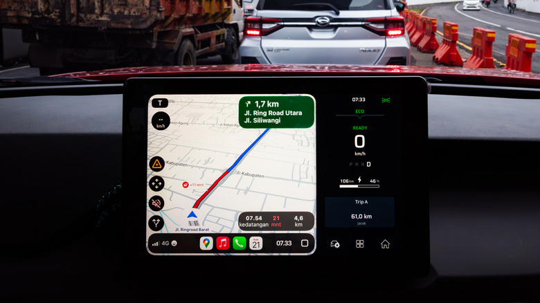
When a user is actively navigating using a smartphone or an integrated car dashboard system running Android Auto or Apple CarPlay, a dedicated "Report" icon remains visible on the interface. Tapping this icon opens a menu of common road events, including accidents, slow-downs, construction, lane closures, objects on the road, and police presence. Selecting the "Police" option instantly logs the location, dropping a small marker at the user’s current coordinates.
For drivers who prefer not to receive these alerts, Google Maps offers customization settings. Users can toggle police and speed camera notifications on or off by navigating to Settings, selecting Navigation, and adjusting the Alert options. It is worth noting that the availability of these features can vary significantly depending on local municipal regulations and regional laws. While the option is widely available to users in the United States and many other territories, certain international jurisdictions have enacted strict legislation restricting or banning apps that broadcast the precise locations of law enforcement checkpoints, prompting companies to disable the feature in those specific areas.
Broader Implications, Safety Concerns, and Regulatory Debates
The ability of GPS apps to pinpoint police presence has sparked significant debate among urban planners, law enforcement agencies, and traffic safety advocates. The technology occupies a complex space between consumer convenience and regulatory compliance, yielding both positive safety outcomes and notable enforcement challenges.
On one hand, proponents argue that real-time police notifications serve as an effective mechanism for speed reduction. When motorists are alerted to the potential presence of law enforcement ahead, they instinctively reduce their speed and drive with heightened caution. This behavioral shift can lead to a more uniform flow of traffic, fewer sudden braking incidents, and a reduction in high-speed collisions. For many everyday commuters, these alerts function as a helpful reminder to adhere to posted speed limits, ultimately helping them avoid costly traffic citations.
Conversely, law enforcement agencies have frequently raised concerns regarding the misuse of these reporting features. Critics point out that real-time tracking can be exploited by motorists attempting to evade lawful checkpoints, such as sobriety checkpoints designed to catch drivers operating under the influence. By utilizing crowdsourced maps to route around police blockades, impaired or reckless drivers can bypass law enforcement scrutiny, potentially increasing risks to the general public.
Furthermore, police unions and municipal officials have occasionally argued that broadcasting the exact locations of patrol vehicles compromises officer safety and undermines targeted traffic enforcement strategies designed to deter dangerous driving habits. Despite these ongoing concerns, navigation companies continue to refine their algorithms and user interfaces, balancing the demands of public safety, regulatory compliance, and consumer expectations in an increasingly connected automotive landscape.